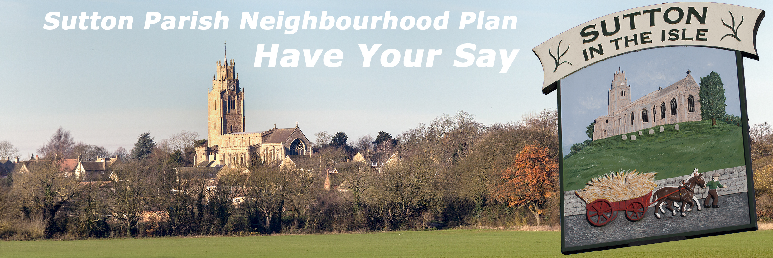
The Neighbourhood Plan Working Party has now finalised the Planning Policies to be included in Sutton’s Neighbourhood Plan.
The Working Party had first defined Objectives across six Topic areas following the Open Forum held in October 2015. They then spent time developing an initial set of draft policies which were published for review in July 2016. Consultation feedback was received from local residents over the following two months. The Working Party subsequently worked with a professional planning consultant to incorporate residents’ feedback and refine the policies.
Some proposed policies have been reframed as Community Actions because they fall outside of the formal definition of a planning policy. The remaining policies have been revised and reordered.
The initial list of draft policies is available here.
The list of Policies together with the Community Actions included in the pre-submission version of the plan are listed below. Note the final set of Policies and Community Actions are included in the version of the local plan submitted for Independent Examination:
Plan Policies
Policy NP1 ‐ Local Green Spaces
Local Green Spaces are designated at:
The play area and open space at Stirling Way;
The churchyard and burial ground;
Stanker’s Pond, Station Road
Allotments, Lawn Lane
Allotments, south of The Row
The Sports Fields off The Brook; and
The Old Recreation Ground, Lawn Lane
and are identified on the Proposals Map.
Development on these sites will only be permitted in exceptional circumstances, as set out by national policy. Permitted development rights, including the operational requirements of infrastructure providers, are not affected by this designation.
Policy NP2 – Protecting and Maintaining Features of Landscape and Biodiversity Value
All development proposals will be expected to retain existing features of landscape and biodiversity value (including trees, woodland, hedgerows, the open nature of meadowland and verges) and, where practical to do so, provide a net gain in biodiversity through, for example:
the creation of new natural habitats;
the planting of additional trees and hedgerows; and
restoring and repairing fragmented biodiversity networks.
Where loss or damage is unavoidable, the benefits of the development proposals must be demonstrated clearly to outweigh any impacts and the development shall provide for appropriate replacement planting on site together with a method statement for the ongoing care and maintenance of that planting.
Where a new access is created, or an existing access is widened through an existing hedgerow, a new hedgerow of native species shall be planted on the splay returns into the site to maintain the appearance and continuity of hedgerows in the vicinity.
Policy NP3 – Sutton Development Envelope
The Sutton Development Envelope is defined on the Proposals Map. Sustainable development proposals within the Envelope will be supported in principle subject to being of an appropriate scale and not having an unacceptable impact on:
the amenity of residents;
the historic and natural environment;
the provision of services and facilities; and
the highway network.
Land outside the Development Envelope is defined as countryside where development will only be allowed for agriculture, horticulture, forestry, outdoor recreation and other uses which can demonstrate a need to be located in the countryside.
Policy NP4 ‐ Land north of The Brook and west of Mepal Road
The site is allocated for:
up to 250 homes, including affordable homes, providing a mix of house types and sizes from starter homes to family homes and retirement homes to meet the requirements of the village;
integrated and expanded community facilities including:
a new village green, all weather pitch and sports pitches located adjacent to the existing facilities at the primary school and Brooklands Centre;
areas of play for infants, juniors and youths at appropriate locations throughout the development in accordance with adopted guidelines;
the provision of land for a burial ground on‐site, or the facilitation of provision at a suitable location elsewhere in the village;
the retention of existing landscape features and provision of new extensive landscape and wildlife areas and landscape screening from the A142;
safe routes for pedestrians and cyclists from the site to the village centre (through The Orchards), primary school and recreation facilities (through Stirling Way); and
vehicular access from Mepal Road
The site should be developed in accordance with the Concept Statement illustrated in Figure 1 in this Plan.
The whole development should be well integrated within the existing village and should be phased in step with the expansion of local infrastructure, particularly schools and health facilities with particular attention to the expansion of the capacity of the village primary school. Developer contributions may be necessary to mitigate the impact of the development on school places. If a practical solution to expand the primary school (in order to mitigate the impact of the development) does not exist, then a reduction in the residential capacity of the site will be necessary to the point where mitigation becomes deliverable.
A detailed Travel Assessment and Travel Plan should be prepared for the whole development that must demonstrate, amongst other matters, how any adverse impacts on the local highway network will be mitigated. This Assessment should pay particular attention to demonstrating how cost‐effective improvements to the transport network will be provided, as required by policies LP16 and LP17 of the East Cambridgeshire Local Plan, in order to appropriately mitigate against the impacts of development.
Policy NP5 – Land East of Garden Close
The site is allocated for up to 25 dwellings that:
are predominantly low‐density single‐storey dwellings;
retains existing mature trees and hedgerows;
preserves and enhances views from the south towards the Church, from Lawn Lane eastwards and Station Road westwards across the cricket fields and open spaces;
The site should be developed in accordance with the Concept Statement illustrated in Figure 2 in this Plan.
A site‐specific flood risk assessment of the site will be required to be submitted as part of a planning application for the development. Development of the site should provide betterment, mitigation and management of flood risk, particularly in relation to surface and/or groundwater matters.
Policy NP6 – Land North of Mill Field, Mepal Road
0.39 hectares of land north of Mill Field is allocated for up to 10 dwellings that:
retains the existing screen belt to the north and east of the site boundary; and
provides measures to reduce the impact on occupants of traffic noise from the A142;
Policy NP7 – Housing Mix
Housing development must contribute to meeting the needs of the village. Planning proposals will be supported where development provides a mix of housing types and sizes that reflects the needs of local people, particularly in the need for two bedroomed dwellings as well as the needs of an ageing population looking to downsize into homes suitable for lifetime occupation.
Policy NP8 – Preserving the Historic Characteristics of Sutton
Proposals for new development should demonstrate how they protect the historic assets of the village, including Listed Buildings, Buildings of Local Interest, the designated Conservation Area and other areas including older buildings in The Row, Pound Lane, Station Road and Sutton Gault, as identified on the Proposals Map, with the aim of preserving the historic characteristics of the village.
Policy NP9 ‐ Protecting existing services and facilities
Proposals that will result in the loss of valued facilities or services which support a local community (or premises last used for such purposes) will only be permitted where:
it can be demonstrated that the current use is not economically viable nor likely to become viable. Where appropriate, supporting financial evidence should be provided including any efforts to advertise the premises for sale for a minimum of 12 months; and
it can be demonstrated that there is no local demand for the use and that the building/site is not needed for any alternative social, community or leisure use; or
alternative facilities and services are available, or replacement provision is made, of at least equivalent standard, in a location that is accessible to the community it serves with good access by public transport or by cycling or walking.
Policy NP10 – Elean Business Park
Further development of the Elean Business Park for employment uses will be supported where they include small business start‐up units and make provision for safe pedestrian and cycling routes between the Business Park and the main part of the village.
Policy NP11 – Retail premises
Planning applications for the loss or change of use of shops (or premises last used as shops) will not be permitted unless it can be demonstrated that the use is no longer viable or that the change of use will not have a detrimental impact on the vitality and viability of the centre. Proposals for new or extended shops or services within the existing centre, as defined on the Proposals Map, will be permitted provided that there is no adverse effect on residential amenity or environmental quality or the role, function and hierarchy of other centres in the district.
Policy NP12 – Sport and Recreation Facilities
Proposals for the provision, enhancement and/or expansion of sport or recreation open space or facilities will be permitted subject to compliance with other Policies in this and other adopted Local Plans. Development which will result in the loss of existing sport or recreation open space or facilities will not be allowed unless:
it can be demonstrated that the space or facility is surplus to requirement against the local planning authority’s standards for the particular location, and the proposed loss will not result in a likely shortfall during the plan period; or
replacement for the space or facilities lost is made available, of at least equivalent quantity and quality, and in a suitable location to meet the needs of users of the existing space or facility.
Any replacement provision should take account of the needs of the village and the current standards of open space and sports facility provision adopted by the local planning authority.
For the purposes of this policy, the Cricket Field is identified as a Sport and Recreation Facility on the Proposals Map.
A more detailed map of Sutton village and surroundings is here: Proposal Map insert
Community Actions
Community Action 1
The Parish Council will work with Sutton Conservation Society to create an informal nature reserve on the old recreation ground.
Community Action 2
The Parish Council will work with the County Council’s Rights of Way officer to promote existing and new permissive access to provide several circular routes for walkers out into the surrounding countryside from the village.
Community Action 3 – Play Areas and Youth Facilities
The Parish Council will seek to identify a location for a new equipped youth recreation facility in the village and to enhance the Stirling Way play area for juniors and toddlers.
Community Action 4
The Parish Council will continue to lobby for weight restrictions to prevent HCV traffic using the B1381 as a short cut to and from the A14 and instead to use the Freight Advisory Routes.
Community Action 5
The Parish Council will work with the County Council to reduce traffic speed and improve crossing points in the village.
Community Action 6
The Parish Council will investigate ways to promote ‘Sport for All’ across all sections of the community, including consideration of suitable locations for new facilities.
Policies
The Neighbourhood Plan Working Party has now finalised the Planning Policies to be included in Sutton’s Neighbourhood Plan.
The Working Party had first defined Objectives across six Topic areas following the Open Forum held in October 2015. They then spent time developing an initial set of draft policies which were published for review in July 2016. Consultation feedback was received from local residents over the following two months. The Working Party subsequently worked with a professional planning consultant to incorporate residents’ feedback and refine the policies.
Some proposed policies have been reframed as Community Actions because they fall outside of the formal definition of a planning policy. The remaining policies have been revised and reordered.
The initial list of draft policies is available here.
The list of Policies together with the Community Actions included in the pre-submission version of the plan are listed below. Note the final set of Policies and Community Actions are included in the version of the local plan submitted for Independent Examination:
Plan Policies
Policy NP1 ‐ Local Green Spaces
Local Green Spaces are designated at:
and are identified on the Proposals Map.
Development on these sites will only be permitted in exceptional circumstances, as set out by national policy. Permitted development rights, including the operational requirements of infrastructure providers, are not affected by this designation.
Policy NP2 – Protecting and Maintaining Features of Landscape and Biodiversity Value
All development proposals will be expected to retain existing features of landscape and biodiversity value (including trees, woodland, hedgerows, the open nature of meadowland and verges) and, where practical to do so, provide a net gain in biodiversity through, for example:
Where loss or damage is unavoidable, the benefits of the development proposals must be demonstrated clearly to outweigh any impacts and the development shall provide for appropriate replacement planting on site together with a method statement for the ongoing care and maintenance of that planting.
Where a new access is created, or an existing access is widened through an existing hedgerow, a new hedgerow of native species shall be planted on the splay returns into the site to maintain the appearance and continuity of hedgerows in the vicinity.
Policy NP3 – Sutton Development Envelope
The Sutton Development Envelope is defined on the Proposals Map. Sustainable development proposals within the Envelope will be supported in principle subject to being of an appropriate scale and not having an unacceptable impact on:
Land outside the Development Envelope is defined as countryside where development will only be allowed for agriculture, horticulture, forestry, outdoor recreation and other uses which can demonstrate a need to be located in the countryside.
Policy NP4 ‐ Land north of The Brook and west of Mepal Road
The site is allocated for:
The site should be developed in accordance with the Concept Statement illustrated in Figure 1 in this Plan.
The whole development should be well integrated within the existing village and should be phased in step with the expansion of local infrastructure, particularly schools and health facilities with particular attention to the expansion of the capacity of the village primary school. Developer contributions may be necessary to mitigate the impact of the development on school places. If a practical solution to expand the primary school (in order to mitigate the impact of the development) does not exist, then a reduction in the residential capacity of the site will be necessary to the point where mitigation becomes deliverable.
A detailed Travel Assessment and Travel Plan should be prepared for the whole development that must demonstrate, amongst other matters, how any adverse impacts on the local highway network will be mitigated. This Assessment should pay particular attention to demonstrating how cost‐effective improvements to the transport network will be provided, as required by policies LP16 and LP17 of the East Cambridgeshire Local Plan, in order to appropriately mitigate against the impacts of development.
Policy NP5 – Land East of Garden Close
The site is allocated for up to 25 dwellings that:
The site should be developed in accordance with the Concept Statement illustrated in Figure 2 in this Plan.
A site‐specific flood risk assessment of the site will be required to be submitted as part of a planning application for the development. Development of the site should provide betterment, mitigation and management of flood risk, particularly in relation to surface and/or groundwater matters.
Policy NP6 – Land North of Mill Field, Mepal Road
0.39 hectares of land north of Mill Field is allocated for up to 10 dwellings that:
Policy NP7 – Housing Mix
Housing development must contribute to meeting the needs of the village. Planning proposals will be supported where development provides a mix of housing types and sizes that reflects the needs of local people, particularly in the need for two bedroomed dwellings as well as the needs of an ageing population looking to downsize into homes suitable for lifetime occupation.
Policy NP8 – Preserving the Historic Characteristics of Sutton
Proposals for new development should demonstrate how they protect the historic assets of the village, including Listed Buildings, Buildings of Local Interest, the designated Conservation Area and other areas including older buildings in The Row, Pound Lane, Station Road and Sutton Gault, as identified on the Proposals Map, with the aim of preserving the historic characteristics of the village.
Policy NP9 ‐ Protecting existing services and facilities
Proposals that will result in the loss of valued facilities or services which support a local community (or premises last used for such purposes) will only be permitted where:
Policy NP10 – Elean Business Park
Further development of the Elean Business Park for employment uses will be supported where they include small business start‐up units and make provision for safe pedestrian and cycling routes between the Business Park and the main part of the village.
Policy NP11 – Retail premises
Planning applications for the loss or change of use of shops (or premises last used as shops) will not be permitted unless it can be demonstrated that the use is no longer viable or that the change of use will not have a detrimental impact on the vitality and viability of the centre. Proposals for new or extended shops or services within the existing centre, as defined on the Proposals Map, will be permitted provided that there is no adverse effect on residential amenity or environmental quality or the role, function and hierarchy of other centres in the district.
Policy NP12 – Sport and Recreation Facilities
Proposals for the provision, enhancement and/or expansion of sport or recreation open space or facilities will be permitted subject to compliance with other Policies in this and other adopted Local Plans. Development which will result in the loss of existing sport or recreation open space or facilities will not be allowed unless:
Any replacement provision should take account of the needs of the village and the current standards of open space and sports facility provision adopted by the local planning authority.
For the purposes of this policy, the Cricket Field is identified as a Sport and Recreation Facility on the Proposals Map.
Proposals Maps
The map showing the complete Neighbourhood Plan area is here: Proposal Map overview
A more detailed map of Sutton village and surroundings is here: Proposal Map insert
Community Actions
Community Action 1
The Parish Council will work with Sutton Conservation Society to create an informal nature reserve on the old recreation ground.
Community Action 2
The Parish Council will work with the County Council’s Rights of Way officer to promote existing and new permissive access to provide several circular routes for walkers out into the surrounding countryside from the village.
Community Action 3 – Play Areas and Youth Facilities
The Parish Council will seek to identify a location for a new equipped youth recreation facility in the village and to enhance the Stirling Way play area for juniors and toddlers.
Community Action 4
The Parish Council will continue to lobby for weight restrictions to prevent HCV traffic using the B1381 as a short cut to and from the A14 and instead to use the Freight Advisory Routes.
Community Action 5
The Parish Council will work with the County Council to reduce traffic speed and improve crossing points in the village.
Community Action 6
The Parish Council will investigate ways to promote ‘Sport for All’ across all sections of the community, including consideration of suitable locations for new facilities.